Cities in Latin America and the Use of Risk Analysis with GIS in Climate Action
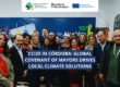
The virtual event “Smart Cities: Risk Analysis with GIS” occurred on September 29th. It was organized by the Red Argentina de Municipios Frente al Cambio Climático (RAMCC, in Spanish), with support from the Global Covenant of Mayors for Climate & Energy (GCoM) in Latin America. The event covered topics such as using geographic information systems to gather, manage, and analyze data to strengthen climate action planning.
Representing the European Union (EU), the EU Ambassador to Argentina, Amador Sánchez Rico, highlighted that since 2017, the institution has been funding the Global Covenant of Mayors in the region, intending to strengthen and deepen support to its signatory cities and municipalities.
“The European Union develops this initiative to support cities and local governments because local actors are on the front lines, where the reality and daily work of global strategies take place,” emphasized Sánchez Rico.
Within the Global Covenant of Mayors, member municipalities have a wide support network, exchange experiences, and receive tools to develop a local climate action strategy to reduce vulnerability to extreme weather events. In this regard, the Ambassador pointed out that “today we want to show how one of these tools is useful for local action, which is the use of geographic information systems technology.”
The GCoM was represented by senior expert Marja Edelman, who presented the initiative to the participants and showcased data on progress in the Latin American region.
“The Global Covenant of Mayors envisions a world in which committed mayors and local governments, in partnership with allies, accelerate ambitious and measurable climate and energy initiatives that lead to an inclusive, just, low-emission, and climate-resilient future, helping to meet and exceed the goals of the Paris Agreement,” highlighted Edelman.
From RAMCC, Executive Director Ricardo Bertolino presented the institution and how they have supported Argentinian municipalities in advancing their local climate action plans.
One of the projects highlighted by Bertolino was the Local Green Jobs, also funded by the European Union. These jobs preserve the environment through sustainable production models, strengthen local and regional economies, and generate decent work and social inclusion.
The use of GIS by cities
Aldo Treville, a researcher and representative of the Joint Research Centre (JRC) of the European Commission, introduced the topic.
Treville explained that GISs are tools that integrate and relate various components, allowing for the organization, storage, manipulation, analysis, and modeling of large amounts of data from the real world. They are linked to spatial reference, facilitating incorporating social-cultural, economic, and environmental aspects that lead to more effective decision-making.
Following that, the municipalities of San Benito, Argentina; Matosinhos, Portugal; Ambato, Ecuador; Rio de Janeiro, Brazil; and Tópaga, Colombia, presented their experiences of climate planning with GIS. The presentations are available in the event video.